← Back to trails
Pico · PR18PIC
Canadas da Ribeirinha
A linear route from Terra Alta to Calhau along Ribeirinha's old lanes, viewpoints, wine cellars, vineyards and small harbours.
Open
Status checked · July 25, 2026, 14:44
Unofficial information that may change at any time. Confirm the trail status before setting out.
When did you walk it?
How is the trail?
Your report shows here once our editors have reviewed it, and stays up for 14 days.
Share a photo
Only send photos you took yourself. Once reviewed, it is published with the credit “Foto: Açores 9 member”.
Loading the route…
About the route
Canadas da Ribeirinha links Terra Alta with Calhau, crossing northeastern Pico on old working lanes. It begins along Canada da Atalhada, where repeated ox-cart traffic has left wheel ruts cut into the surface. The descent enters vegetation of Australian cheesewood, faya, Azorean laurel and holly, crosses the regional road and returns to rural paths, alternating shade, small properties and openings toward the coast.
A short detour reaches Alto dos Cedros viewpoint, looking toward São Jorge. Back on the route, the walk passes a fountain, crosses Rocha Alta and enters Ribeirinha village. At the far end of the settlement, Canada do Mar drops to Baixa harbour, where traditional cellars, small vineyard enclosures and access to the ocean appear. This approach to the sea changes the setting from woodland and road to a coastal landscape of work and recreation.
The trail continues near the shore among heather, returns briefly to the road and leaves it again toward Ponta das Trombetas. It finishes at Calhau beside the small harbour, where it connects with the Ponta da Ilha route. This is an easy crossing but a sustained descent, showing how lanes, fountains, vineyards and ports once linked Ribeirinha's interior with the Atlantic edge.
Directions
At Terra Alta, locate the start beside the ER1 and enter Canada da Atalhada. Descend through woodland, cross the road and continue by the markings until meeting asphalt again. If desired, take the short left-hand detour to Alto dos Cedros viewpoint and return the same way. Pass the fountain, turn left at Rocha Alta and cross Ribeirinha. At the far end of the village, descend left along Canada do Mar to Baixa harbour. Then follow the coast, return to the road by the markings and leave it again toward Ponta das Trombetas. Continue to Calhau and finish beside the harbour. Arrange transport back to Terra Alta or continue only on a properly planned connection.
Safety
The trail is open. Its descent includes rough stone, wheel ruts, damp earth and road crossings, so wear sturdy footwear and stop before crossing. Use the verge on asphalt and leave gates as found. Carry water and protection from rain, wind and sun. At Baixa harbour and Calhau, do not enter the sea in strong swell. Connecting with another trail increases distance and time and should only be attempted with suitable logistics.
Elevation profile
- Minimum
- 12 m
- Maximum
- 390 m
- Distance
- 8.7 km
- Points
- 19
390 m
12 m
Near the trailhead
Places a short distance from the starting point.
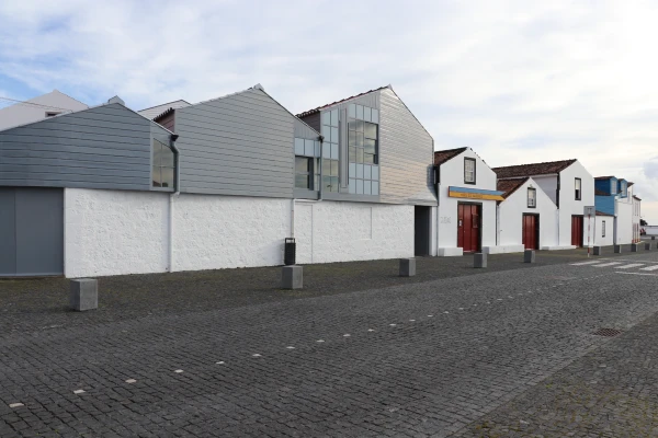 Museums and Theaters
Closed now
Museums and Theaters
Closed now
Whaling Museum
Lajes do Pico museum devoted to Azorean artisanal whaling, with historic boathouses, exhibitions, an archive, specialist library and educational services.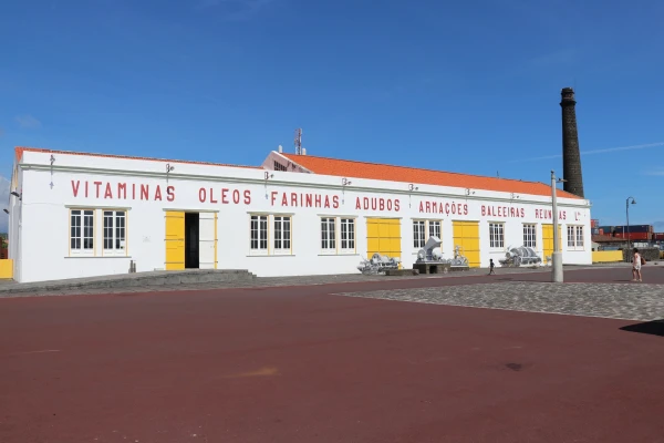 Museums and Theaters
Closed now
Museums and Theaters
Closed now