 Museums and Theaters
Closed now
Museums and Theaters
Closed now
← Back to trails
Pico · PR15PIC
Mistérios do Sul do Pico
A coastal walk through the lava fields of Mistério de São João and Mistério da Silveira, tidal wells, rural heritage and bathing areas.
Open
Status checked · July 25, 2026, 14:44
Unofficial information that may change at any time. Confirm the trail status before setting out.
When did you walk it?
How is the trail?
Your report shows here once our editors have reviewed it, and stays up for 14 days.
Share a photo
Only send photos you took yourself. Once reviewed, it is published with the credit “Foto: Açores 9 member”.
Loading the route…
About the route
Mistérios do Sul do Pico follows the coast between the Mistério de São João Forest Park and Silveira. Its name recalls the word islanders used for lava flows whose origin they did not yet understand. Along the route are landscapes created by the historic 1718 eruption at Mistério de São João and the 1720 eruption at Mistério da Silveira. Lava now occupied by vegetation and rural paths still defines the terrain and the relationship between settlements and the sea.
The itinerary passes old tidal wells once used for household water, including those at Baía do Arruda, Ponta do Admoiro, Verdoso and Maré do Rego. Other landmarks include the Ponta Rasa windmill, built in 1949, small Holy Spirit chapels and São João church. Bathing areas such as Ponta do Admoiro, Arinhas and Fonte bring the walk close to the shoreline, while farm lanes and inhabited pockets show the continuity of local life across the lava fields.
The final part approaches Silveira and São Bartolomeu church. This is an easy linear trail, yet long enough to provide a broad reading of southern Pico: historic volcanism, water collected by the ocean, religious heritage and modest leisure areas follow one another in a landscape where natural processes and community memory remain closely connected.
Directions
Begin in the Mistério de São João Forest Park and follow the linear markings east toward Silveira. The route crosses lava terrain associated with Mistério de São João and successively approaches tidal wells and coastal access points at Baía do Arruda, Ponta do Admoiro, Verdoso and Maré do Rego. Continue by the signs toward Ponta Rasa windmill and through the inhabited and religious landmarks of São João. The trail also passes the Arinhas and Fonte areas before entering Mistério da Silveira. Finish beside São Bartolomeu church in Silveira. Because the two ends are separate, leave transport at the finish or arrange collection before setting out.
Safety
The trail is open. Wear grippy footwear on lava, lanes and stone sections, which can become slippery in rain or sea spray. The coast is exposed to sun, wind and rapid weather changes, so carry water, sun protection and waterproof clothing. Stay on the route to avoid damaging habitats and private ground. At tidal wells and bathing areas, respect wave conditions and remain away from the water when surf is strong.
Elevation profile
- Minimum
- 10 m
- Maximum
- 78 m
- Distance
- 8.5 km
- Points
- 50
78 m
10 m
Near the trailhead
Places a short distance from the starting point.
Museums and Theaters
Closed now
 Museums and Theaters
Closed now
Museums and Theaters
Closed now
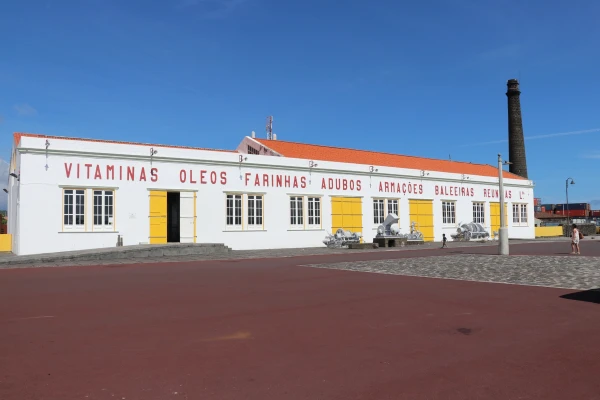
Whaling Industry Museum
The Azores' first public industrial museum, in São Roque do Pico, preserves a former factory and equipment once used to process sperm whales. Museums and Theaters
Closed now
Museums and Theaters
Closed now