← Back to trails
São Miguel · PRC05SMI
Serra Devassa
An upland circuit across Serra Devassa through lakes, wetlands, springs and wide views towards Sete Cidades.
Open
Status checked · July 25, 2026, 14:44
Unofficial information that may change at any time. Confirm the trail status before setting out.
When did you walk it?
How is the trail?
Your report shows here once our editors have reviewed it, and stays up for 14 days.
Share a photo
Only send photos you took yourself. Once reviewed, it is published with the credit “Foto: Açores 9 member”.
Loading the route…
About the route
Serra Devassa covers 9.1 kilometres through one of São Miguel’s wettest upland landscapes. The circuit begins beside Muro do Carvão, a stone aqueduct associated with water collection, then enters an undulating plateau where small craters retain rainfall. Lagoa do Carvão, Caldeirão Grande and Caldeirão Pequeno appear as different expressions of the same volcanic ground.
The climb to Pico das Éguas broadens the view over this mosaic of lakes, boggy ground, pasture and woodland. Near the summit, Lagoas das Éguas occupy subtle depressions, while springs and collection points recall the plateau’s importance to water supply. The trail then continues towards Lagoas Empadadas, enclosed by denser vegetation, and approaches Mata do Canário. In clear weather, the coast and the great Sete Cidades caldera appear beyond the interior ridges.
The circuit also includes the Lagoa do Canário area and the elevated perspective from Grota do Inferno, where a succession of craters and inland waters can be seen. A medium rating and estimated three and a half hours reflect frequently wet ground, short climbs and weather exposure. More than a sequence of viewpoints, the route reveals an interconnected system of volcanism, water retention, upland vegetation and collection infrastructure within a protected landscape.
Directions
Start beside Muro do Carvão and follow the circuit past Lagoa do Carvão and Caldeirão Grande and Pequeno. Climb Pico das Éguas and stay with the waymarks beside Lagoas das Éguas before continuing to Lagoas Empadadas. The route enters Mata do Canário, approaches Lagoa do Canário and passes the signed access to Grota do Inferno. Complete the loop back to Muro do Carvão without taking shortcuts across bogs, springs or water-collection areas. Allow about three and a half hours to complete the 9.1-kilometre circuit and keep a margin of daylight, including time for signed branches and stops.
Safety
Fog, wind and rain can develop quickly on the plateau; carry waterproof protection and turn back if waymarks disappear. Bogs and lake margins are fragile and may conceal saturated ground, so remain on the trail. Do not touch water-collection equipment and carry out all litter. Waterproof footwear with reliable grip is essential. Carry a charged phone and, in an emergency, call 112 with PRC05SMI and the number of the last route post seen.
Elevation profile
- Minimum
- 687 m
- Maximum
- 823 m
- Distance
- 9.1 km
- Points
- 11
823 m
687 m
Near the trailhead
Places a short distance from the starting point.
Pico do Carvão Viewpoint
Sete Cidades viewpoint overlooking the mountain massif, north and south coasts, a broad expanse of volcanic cones, and several surrounding lagoons.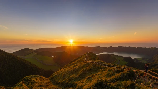 Viewpoints