← Back to trails
Pico · PRC11PIC
Calheta do Nesquim
A coastal and rural circuit around Calheta do Nesquim among whaling heritage, vineyards, pasture, lookouts and small harbours.
Open
Status checked · July 25, 2026, 14:44
Unofficial information that may change at any time. Confirm the trail status before setting out.
When did you walk it?
How is the trail?
Your report shows here once our editors have reviewed it, and stays up for 14 days.
Share a photo
Only send photos you took yourself. Once reviewed, it is published with the credit “Foto: Açores 9 member”.
Loading the route…
About the route
The Calheta do Nesquim circuit begins at the harbour in front of São Sebastião church, built in 1852. The parish retains a strong connection with whaling, visible in the heritage around Terreiro and the House of Whaling Boats. The opening section follows the coast toward Feteira harbour, a small leisure area with access to natural pools. Soon afterwards, the maritime setting gives way to a sustained climb.
The route crosses mixed vegetation and Fetais woodland, reaching a dirt road on higher ground. From here there are views over the village, Pedra Aguda and Cabeço do Silvado. The descent begins at Cascalheira, first on asphalt and then on a dirt path through Australian cheesewood. Woodland gradually opens into farm fields, pasture and small vineyards, revealing the transition between damp hillside and cultivated ground.
Partway down stands a whale lookout that provides a place to pause and observe the coast. Lower on the route, the trail returns to the road and approaches Poça das Mujas and the Morro do Cão windmill, also known as Murricão. The loop then returns to the harbour. This is a varied medium-grade walk whose demanding climbs are balanced by coastal views and a route focused on the parish's maritime heritage.
Directions
Leave from Calheta do Nesquim harbour in front of São Sebastião church and follow the circuit clockwise. Keep with the coastal markings to Feteira harbour. From there, begin the climbing section through mixed vegetation and Fetais woodland. At the top, turn left onto the dirt road and continue on higher ground toward Cascalheira. Start the descent on asphalt, then join the dirt path through woodland, fields, pasture and small vineyards. Pause at the whale lookout without leaving the route. On reaching the road again, turn left toward Poça das Mujas and Murricão windmill, then follow the markings back to the harbour.
Safety
The trail is open. This is an undulating circuit with steep climbs, dirt, asphalt and stone, so wear sturdy footwear and save energy for the second half. Use the verge on roads and take care at crossings. Carry water and protection from sun, wind and rain. At the lookout, near cliffs and by natural pools, remain in safe areas; do not approach the sea in strong swell or interfere with local activity.
Elevation profile
- Minimum
- 11 m
- Maximum
- 309 m
- Distance
- 9.0 km
- Points
- 19
309 m
11 m
Near the trailhead
Places a short distance from the starting point.
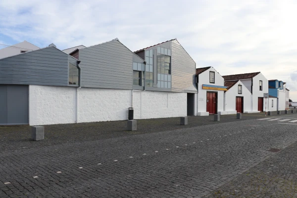 Museums and Theaters
Closed now
Museums and Theaters
Closed now
Whaling Museum
Lajes do Pico museum devoted to Azorean artisanal whaling, with historic boathouses, exhibitions, an archive, specialist library and educational services.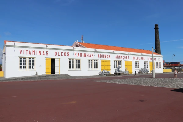 Museums and Theaters
Closed now
Museums and Theaters
Closed now